Scoping
A primary step in managing a forest is to develop
an overview of its current condition and future potential; this is the scoping
process described in The
Decision-Making Approach. The following attributes of the forest
are examined:
PHYSIOGRAPHIC
LAYOUT
Pack Forest consists of 4,300 acres at the juncture
of the Puget Sound Lowlands and Cascade Mountain Range in central western Washington,
near Eatonville. Forest elevations range between 500 and 2,000 feet with slopes
ranging from flat to greater than 80%. Pack Forest can be divided into six physiographic
areas:
- Mashel Flats is an area of gravelly, glacial outwash to the north, bordered by the
Mashel and Nisqually Rivers.
- Murphy's Ranch is a lacustrine area dissected by the Little Mashel River.
- Hugo/Canyon Loop, and Bethel Ridge are high, steep ridges
which escaped glaciation.
- Southeast
is an unglaciated area of more gentle slope.
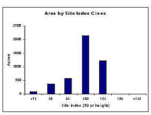
SITE PRODUCTIVITY
|
Soils at Pack Forest are predominantly
moderately productive soils (average site index: 109 ft at 50 yrs, King
1966). The most productive sites (site index: 120 ft at 50 yrs) are found
in the concave slopes of residual soils at upper elevations. The least
productive sites (site index: 75 ft at 50 yrs) are found in the Mashel
Flats area, a flat, low elevation site of gravelly outwash. |
 |
FOREST AGE
DISTRIBUTION
|
Most of Pack Forest's stands developed as the
result of three disturbance episodes:
- A natural fire which burned most of the present
Pack Forest area in 1800 and created the ~170-year age class.
- The early logging and fires (e.g., Eatonville
Fire) between 1900 and 1935 that created the 60- to 80-year age class.
- More recent harvesting and replanting of
abandoned agriculture fields, especially associated with newly acquired
lands, that created the stands less than 30 years old.
|
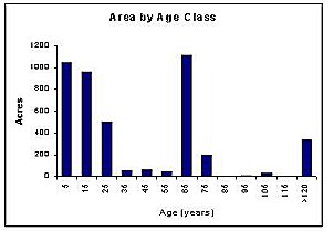 |
The distribution of age classes is generally independent
of site index; that is, each of the three main age classes contain a similar
proportion of sites in each site index class. The major exception is the low
site quality area of the Mashel Flats, which has only been harvested in the
past 30 years. This has created a large area (~550 acres) of low site index
stands in the youngest age group.
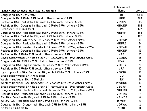
TREE SPECIES
DISTRIBUTION
Douglas-fir is the dominant tree species at Pack
Forest. It occurs in nearly pure stands (i.e., >75% stand basal area) as well
as mixed stands (i.e., stands in which other species account for >25% of the
basal area). Stands are classified by their relative species dominance as shown
below:
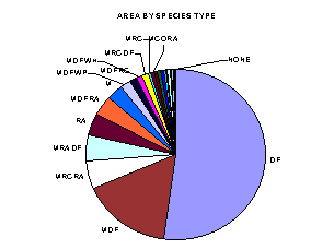
Less productive sites such as the Mashel Flats tend
to be dominated by Douglas-fir; whereas the more productive soils have mixtures
of species or are dominated by species other than Douglas-fir.
FIRE HISTORY
Like most areas of the Pacific Northwest Pack Forest has experienced
occasional stand replacing fires. The areas indicated at the right are
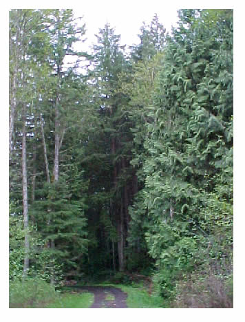
examples of stands that contain relic trees that survived pre-1800 fires.
|
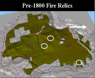 |
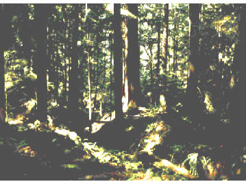
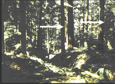
| Examples of relict trees in stand where everything else is slightly
under 200 years old. |
Examples
of two relict trees in stand where everything else is slightly under 200
years old. (fallen tree and big one in center back are relics.) |
 |
|
Eatonville
Fire
|
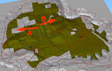
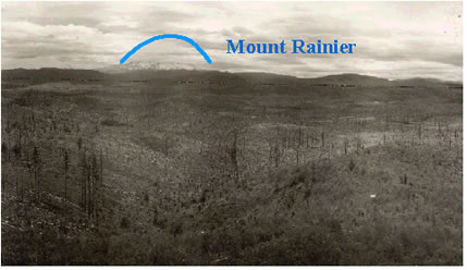
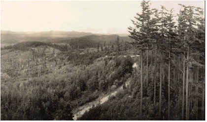
A major fire in the
Eatonville area burns much of Pack Forest around 1920. The map at right
show the approximate view directions for the following photographs. The
photographs were taken in 1934.
The picture on the left is looking toward the east with Mount Rainier
in the background.
The picture on the lower right shows the mosaic created by the fire
with young stands regenerating and old stands to the right. |
 |
|
A.
|
B.
|
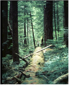
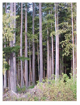
| The
following stands are examples stands that have developed since the Eatonville
Fire. |
 |
 |
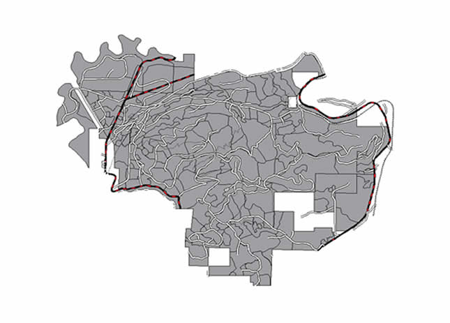
ROAD
SYSTEM
Pack Forest has a well maintained road system for
access for demonstration, teaching, and management purposes. The images below
show the road network; forest roads are white, state and county roads are red
and black.
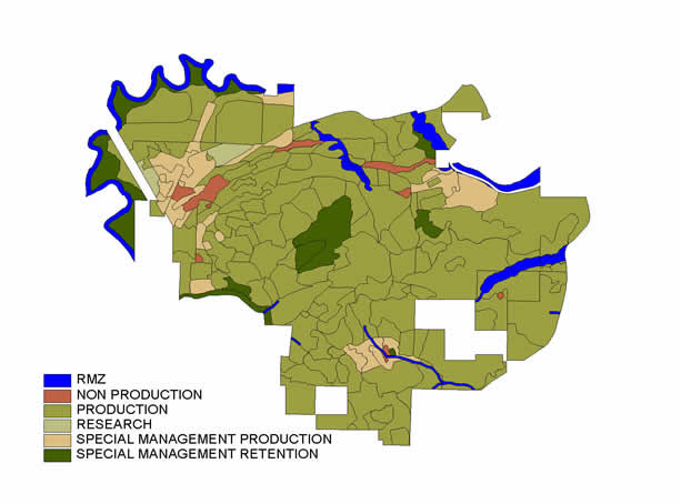
UNIQUE
ATTRACTIONS
Unique attractions to Pack Forest requiring special
management attention include:
- old, complex forests in riparian areas, ecological
area, and Hugo Peak Transect (dark green);
- waterfalls and riparian areas on (blue), significant
wetland areas;
- numerous vista point opportunities
- existing stand-level research sites and special
management areas
Complex forest in ecological area